
Agree or disagree with US government policy, that’s your business, but what we do in this country, we do as a nation. It would seem absurd to us to see the President raise an army to go to war with the Congress, and yet that’s just what happened in 17th century England.
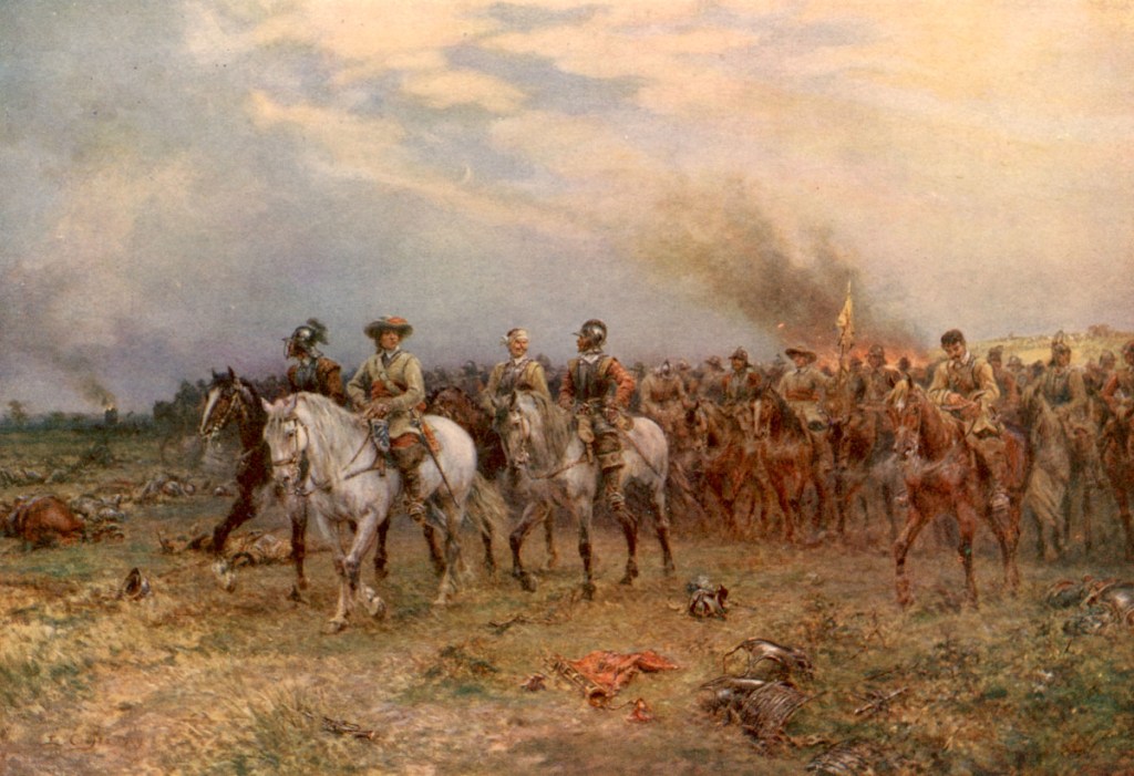
The period 1639-’51 saw a series of intertwined conflicts within and between the three kingdoms, including the Bishops’ Wars of 1639 and ’40, the Scottish Civil War of 1644–’45; the Irish Rebellion of 1641, Confederate Ireland, 1642–’49 and the Cromwellian conquest of Ireland in 1649, collectively known as the Eleven Years War or Irish Confederate Wars and finally, the first, second and third English Civil Wars.
An officer in the British Royal Navy, William Penn served on the side of the Parliament during the first English Civil War of 1642-46′, a conflict which would lead to the execution of the King himself, in 1649. England and Wales came to be governed as a Commonwealth under “Lord Protector” Oliver Cromwell, later followed by Ireland and Scotland.
The experiment proved to be a failure, the interregnum lasting 11 years. In 1660, the dead King’s son was invited to rule as Charles II, King of Scotland, England and Ireland.
One might think an officer’s support of the Parliament would have cost him his head, but William Penn had a gift for landing on his feet. When he died in 1670, King Charles II owed the man money.
Penn’s son, also named William, was a dedicated pacifist, and a Quaker. The younger Penn had utopian ideas he wanted to try out, in the new world. Thus the Charter of 1681 came to be, granting a slice of the forested lands of North America in exchange for money, owed to Penn’s late father. That land came to be called “Penn’s Woods” or, in Latin, Pennsylvania.
It’s why so many Philadelphia streets, are named after trees.
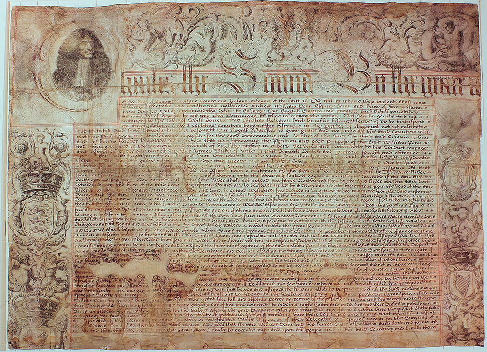
The King’s Charter specified a southern boundary for the new colony to begin at “A circle drawne at twelve miles distance from New Castle Northward and Westward unto the beginning of the fortieth degree of Northern Latitude, and then by a streight Line Westward“.
The problem comes about when you realize that 40° north latitude is north of Philadelphia. Well into territory granted to Lord Baltimore by King Charles I and controlled by Maryland and Delaware.
What is this “Pennsylvania” of which you speak?
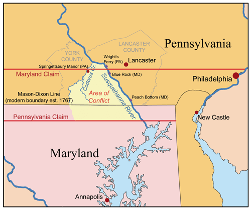
The Maryland colony insisted on the boundary as drawn by Charles II’s Charter, while Pennsylvania proposed a boundary near 39°36′, creating a disputed zone of some 28 miles.
In 1726, Quaker minister John Wright began a ferry service across the Susquehanna River. Starting as a pair of dugout canoes, “Pennsylvania Dutch” farmers were soon settling the Conejohela Valley on the eastern border between Maryland and Pennsylvania.
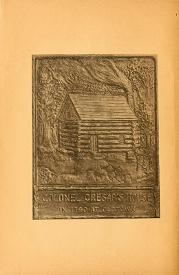
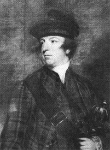
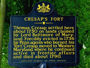
Business was good. By 1730, Wright had applied for a ferry license. With Lord Baltimore fearing a loss of control in the area (read – taxes), Maryland resident Thomas Cresap established a second ferry service up the river. Maryland granted Cresap some 500 acres along the west bank, serenely unconcerned that much of the area was already inhabited by Pennsylvania farmers.
Cresap went to these farmers to collect “quit-rents”, an early form of property tax, for the government in Maryland. Pennsylvania authorities responded by issuing “tickets” to settlers which, while not granting immediate title, amounted to an “IOU” of title under Pennsylvania jurisdiction.
Then came the day when Cresap and his ferry worker were thrown overboard by two Pennsylvanian farmers, probably over a debt. Cresap took the matter to Pennsylvania authorities for justice. The magistrate informed the plaintiff he couldn’t expect justice in his court because he was a “liver in Maryland”. Incensed, Cresap then filed charges with Maryland authorities claiming that, as a Maryland resident, he was no longer bound by Pennsylvania law.
Cresap and his allies began to confiscate York and Lancaster county properties as early as 1734, handing them over to his supporters. Maryland militia crossed colonial borders twice in 1736, and Pennsylvania militia were quick to respond.
CLancaster county Sheriff arrived with a posse to arrest Cresap at his home, when Cresap fired through the door, mortally wounding deputy Knowles Daunt.
When Daunt died, Pennsylvania Governor Patrick Gordon demanded that Maryland arrest Cresap for murder. Samuel Ogle, Governor of Maryland, responded by naming Cresap a captain in the Maryland militia.
Cresap resumed and expanded his raids, destroying barns and shooting livestock. Sheriff Samuel Smith raised a posse to arrest him in November. When the Pennsylvanians set his cabin on fire, Cresap ran for the river. Grabbing him before he could launch a boat, Cresap shoved one of them overboard, shouting, “Cresap’s getting away!”, whereupon the other deputies proceeded to pound their colleague with oars until one of them discovered the ruse.
Cresap was taken to Lancaster, where he decked the blacksmith who had come to put him in shackles. He was finally subdued and hauled off to Philadelphia in chains, but even then the man was anything but broken. “Damn it”, he said, looking around, “this is one of the prettiest towns in Maryland!”
Maryland authorities petitioned George II, King of Great Britain and Ireland, imploring the King to restore order among his loyal subjects. King George’s proclamation of August 18, 1737 instructed the governments of both colonies to cease hostilities.
When that failed to stop the fighting, the Crown organized direct negotiations between the two. Peace was signed in London on May 25, 1738, the agreement providing for an exchange of prisoners and a provisional boundary to be drawn fifteen miles south of the southernmost home in Philadelphia and mandating that neither Maryland nor Pennsylvania “permit or suffer any Tumults Riots or other Outragious Disorders to be committed on the Borders of their respective Provinces.”
So ended the “Conojocular War”, the bloody eight-year conflict between Philadelphia and surrounding area and sometimes referred to as “Cresap’s War”.
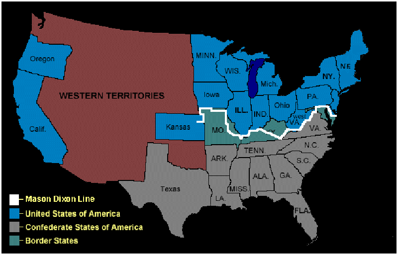
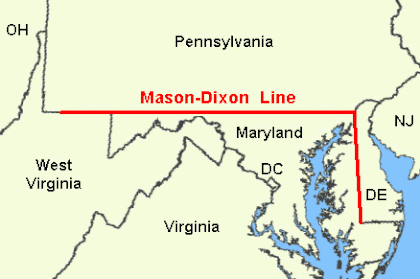
In 1767, descendants of the Penns and Calverts hired surveyors Charles Mason and Jeremiah Dixon to establish a boundary. That original line extended westward, becoming the demarcation between northern “free” states, and Southern “slave” states. The Mason-Dixon line came to renewed prominence during the Missouri Compromise period of 1820 and again, during the Civil War. The Virginia border originally made up part of the line and thus the northern boundary of the Confederacy, until West Virginia seceded to rejoin the union.
Today, the Mason-Dixon line is more of a loose separation, delineating the culture and politics of the South, from those of the North. The area of Cresap’s original conflict is now part of York County, Pennsylvania.
Afterward
During the French & Indian Wars of the 1750s, Thomas Cresap and a party of 100 pursued an Indian war band over the modern-day Savage Mountain and onto the next ridge. Along with the party marched a free black man, a frontiersman known only as “Nemesis”. A fierce fight ensued on May 28, 1756. Nemesis, described as “large and powerfully built”, fought bravely, but lost his life.
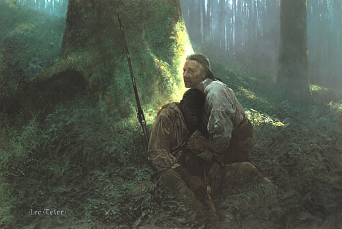
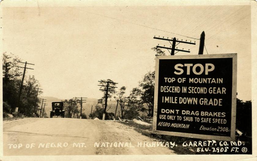
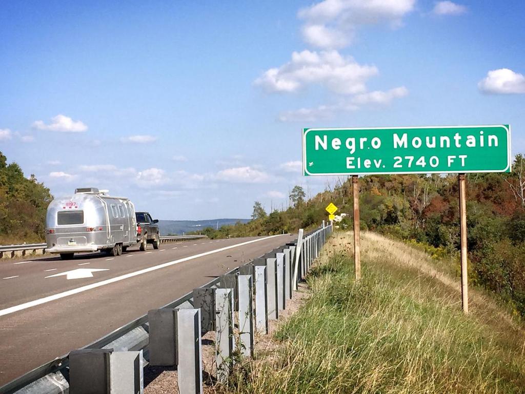
He was buried on the site, the story goes, where Cresap named the mountain in his honor. “Negro Mountain”, the long ridge of the Allegheny Mountains stretching from Deep Creek Lake in Maryland north to the Casselman River in Pennsylvania, stands to this day as his monument.
Eventually, someone took offense at the name. Rosita Youngblood, a Philadelphia politician of African ancestry, said in 2007: “Through a school project, my son and granddaughter first informed me of the name of this range and I found it to be disparaging that we have one of our great works of nature named as such… I find it disheartening for tourists who visit this range to see the plaque with the name Negro Mountain displayed on the mountainside.”
Professor Christopher Bracey is a law professor and associate professor of African and African-American studies at Washington University. Bracey also descends from African ancestors. He contends that: “I must confess I have a slightly different take on it than [Youngblood]… Here we have a mountain, whose name was intended to be a testament to Negro bravery. It seems rather crass and unsophisticated to name it Negro Mountain, but the intentions were strong.”
Measures to rename Negro Mountain and Polish Mountain alike were voted down in the Maryland state senate. As of this writing, road signs have been removed by the Maryland State Highway Administration, citing concerns over “racial sensitivity”.


Reblogged this on Dave Loves History.
LikeLiked by 1 person